A geography puzzle asks a child to reason about places rather than just recall them: decode a message about a river, work out who visited which country from a few clues, or decide which of two cities is farther north. The five puzzles below do exactly that, for ages 8 to 12, with answers and short explanations at the end.
All five were written for this website. They are not excerpts from any of our books, although they use some of the same formats as our puzzle book (more on that after the answers). Nothing here needs to be printed or downloaded: read a puzzle aloud, or put the page on a screen and let the child work on paper.
How to use these puzzles
Each puzzle gives the child everything they need, apart from a few everyday facts that are listed with it. That is deliberate: a puzzle that depends on knowing an obscure capital is a quiz, and a quiz can only be passed by someone who already knows the answer.
- Start with Puzzle 1 or 2. They are the most self-contained.
- Keep an atlas or globe nearby for Puzzle 3. Checking the answer on a real map is half the fun.
- Hold back the answers. Offer a hint first; each puzzle has one.
- Ask "how do you know?" The explanation matters more than the answer, and it is what makes the geography stick.
Puzzle 1: The river code
Every letter in this message has been moved three places forward in the alphabet, so A became D, B became E, and so on. At the end of the alphabet, count on from the start: X became A, Y became B and Z became C.
WKH QLOH IORZV QRUWK LQWR WKH PHGLWHUUDQHDQ VHD
Decode the message. Then find the river on a map and check that it is true.
Hint: the first word is a very common three-letter word. Move each letter three places back to decode it.
Puzzle 2: Four explorers, four countries
Ana, Ben, Cleo and Dev each flew to a different country: Kenya, Peru, Norway or Japan. Use the explorer's notebook and the clues to work out who went where.
Explorer's notebook
- Kenya is in Africa. Its coast is on the Indian Ocean.
- Peru is in South America. Its coast is on the Pacific Ocean.
- Norway is in Europe. Part of it lies north of the Arctic Circle.
- Japan is an island country in Asia, on the Pacific Ocean.
Clues
- Cleo crossed the Arctic Circle.
- Ben and Dev both swam in the Pacific Ocean.
- Dev stayed in the Americas.
Hint: clue 1 has only one possible country. Once Cleo is placed, clue 2 tells you something about Ana.
Puzzle 3: Which is farther?
Guess first, then check on a map or globe. All three are easy to guess wrong, adults included.
- Which city is farther north: Rome, Italy, or New York City?
- Which city is farther west: Reno, Nevada, or Los Angeles, California?
- If you travel due south from downtown Detroit, Michigan, which country are you in when you cross the river?
Hint: maps make our mental pictures tidy. Italy "feels" southern and Nevada "feels" inland, but a city's position does not care how it feels.
Puzzle 4: Odd one out
In each group, three places share something and one does not. Find the odd one out and say why.
- Bolivia, Paraguay, Chile, Mongolia
- Lima, Nairobi, Canberra, Bogotá
Hint: for group 1, think about the sea. For group 2, think about the equator.
Puzzle 5: Scrambled capitals
Each word is the name of a national capital with its letters mixed up. The continent is given as a clue.
| Scrambled | Continent |
|---|---|
| RAPIS | Europe |
| NILREB | Europe |
| MOER | Europe |
| IAROC | Africa |
| WATTOA | North America |
Hint: one of them is the capital of Canada.
Answers and explanations
Puzzle 1
THE NILE FLOWS NORTH INTO THE MEDITERRANEAN SEA. It is true. Its main branches start in East Africa, and the river flows north through Sudan and Egypt to the Mediterranean. Many children assume rivers flow "down" the map, which is why this one is worth checking: rivers flow downhill, and on a map downhill can point in any direction.
Puzzle 2
Ana went to Kenya, Ben to Japan, Cleo to Norway and Dev to Peru. Only Norway reaches north of the Arctic Circle, so Cleo went there (clue 1). Ben and Dev need Pacific coasts, and only Peru and Japan have one, so they took those two and Ana went to Kenya (clue 2). Dev stayed in the Americas, so Dev went to Peru and Ben to Japan (clue 3).
Puzzle 3
- Rome. Rome lies at about 41.9° north and New York City at about 40.7° north, so Rome is a little farther north, even though Italy is usually thought of as a warm, southern country.
- Reno. Reno lies at about 119.8° west and Los Angeles at about 118.2° west. The California coast curves southeast as it runs south, so Los Angeles sits east of a line straight down from Reno.
- Canada. The city of Windsor, Ontario, lies across the Detroit River, and much of it is due south of downtown Detroit. It is a well-known spot where heading south from the United States takes you into Canada.
Puzzle 4
- Chile. Bolivia, Paraguay and Mongolia are all landlocked, with no coastline at all. Chile has a long Pacific coastline that runs the length of the country.
- Bogotá. Lima, Nairobi and Canberra are all in the Southern Hemisphere. Bogotá, the capital of Colombia, is just north of the equator. Nairobi is the trick: it is only about 1° south of the equator, so it is easy to guess wrong.
Puzzle 5
Paris (France), Berlin (Germany), Rome (Italy), Cairo (Egypt) and Ottawa (Canada). Ottawa is the one to watch: it is easy to confuse with Toronto, which is Canada's largest city but not its capital.
How these compare with a full puzzle book
These five are a sampler, written for this website. None of them is taken from the book.
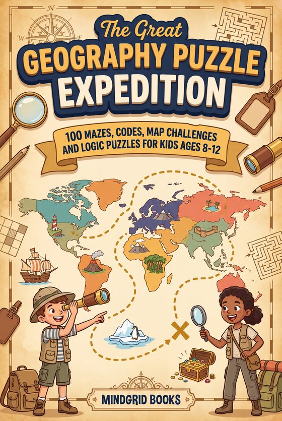
The Great Geography Puzzle Expedition, our puzzle book for ages 8 to 12, is a ready-made sequence of 100 puzzles on a ten-stage trip from North America to Antarctica, so there is always a next puzzle without anyone having to find or write one. It uses formats well suited to pencil-and-paper solving, such as mazes where a geography rule decides which squares are open and map grids that are followed square by square, alongside code breakers and logic puzzles like Puzzles 1 and 2 here. The large pages leave space for pencil work, and the book needs no screen, app or internet connection. Each stage opens with a map and a page of facts, so, as here, the puzzles do not rely on knowledge the child does not have yet.
If a child enjoyed Puzzle 3, the best follow-up is not another puzzle but a real atlas: pick any two cities and guess which is farther north before looking. For flags rather than places, how to teach kids world flags works the same way, by reasoning from patterns instead of memorizing one flag at a time.
Where to go next
- For recall practice rather than reasoning, try the printable geography quiz for kids: 30 questions in three levels, plus a map round.
- For the whole range of our geography books, from atlases to the puzzle book, see geography books for kids.
- To keep going with puzzles like these, see what is inside The Great Geography Puzzle Expedition, including three real pages from its first stage.